Tuesday, December 18, 2007

Marathon Man


I found this picture that my father sent me earlier in the year. It is an article of him on the front of the Aspen Times Weekly. Is this what I get to look forward to in 30 years? His advice on how he beats his competition is that he "outlives them". In just over a year he is going to turn 70, and we are going to go run a few races together, like the Imogene Pass Run.

Monday, December 10, 2007

Street Scramble At The Market

I participated in my first street scramble. The Street Scramble at the Market is a popular holiday event, and was sold out with 300 people registered. A lot of people brought their families and kids for an enjoyable walk/jog around town looking to answer 32 clues relating to statues, murals and holiday decorations. We got our maps a half hour early, and I spent the time writing a few street names onto the map and plotting my route.

When we started, I found that I was running with Roger and Yumay for the first seven our eight checkpoints. I eventually headed up to the hospital to get one of the far-lying checkpoints, whereas Roger decided to skip it (to his later regret when they finished almost half an hour early with only that one checkpoint missed). My path took me up to Capitol Hill, back to downtown, over to Seattle Center and back. I pulled back into the Market Street Theatre in 1:32:45 with lots of time to spare. Nikolay Nachev, a fierce orienteering competitor who wins some of the local O' Meets, arrived only seconds after I did. Wow. My sheet was quickly taken away and the final time written on it. I hope I circled all the answers. My hands were so cold (it was barely above freezing) that I had a hard time using the pen, and some of my circles were chicken scratches. I always worry that points are going to be deducted for illegibility.

It turns out that they could read all my answers, however, and I finished the course with all 1000 points in the fastest time. I am now the proud owner of a small blue ribbon and a few
words of congratulations from Eric Bone, the course designer and orienteer extraordinaire.

The course was very enjoyable and the navigation was minimal. Adding some of the street
names to the map ahead of time was very helpful. Knowing the area also helped a bit - I never felt like I really needed to rely on the map to tell me where I was. I planned out my complete path before I started, wrote it down as a list on the side of my passport, and I stuck with it the whole time. During the race, I enjoyed an inside look at a bunch of the different sights around downtown and a fun and festive race. Thanks Eric and Terry!

Here is the order in which I visited the checkpoints:

*,31,13,48,23,44,22,24,53,43,55,52,42,26,12,41,47,34,15,37,21,
25,32,35,54,46,51,11,56,45,33,36,14,*

Running with Brock

Brock Gavery is a machine when it comes to running. When he asked me to go run 20 miles with him at Discovery Park yesterday, I jumped at the chance to socialize and get to know him better. Apparently he used to be a huge whitewater kayaker, and is good friends with Bryan Smith, who was an instructor with Body Boat Blade when I first took classes there. He has also run several back-to-back 100 mile weeks recently. I asked what race he was training for - he said it was just for fun. I ran my first 60 mile week this week, my longest ever. Now I feel like a slacker.
In any case, don't get into an endurance race with Brock. Even if you can get ahead of him, it's not a matter of if he catches up to you, but when.

Wednesday, December 5, 2007

Beast Race Results

Beast Race results are here:
http://www.beastrace.com/b-results.asp#2007race5

Looks like we were 2nd. Wow. The people that snuck a minute or two in front of us at the end skipped a few of the biking checkpoints (50 minute penalty), and the people in front of them got a wrong answer on one of the checkpoints, which cost them a 15 minute penalty. We lucked out a bit. I guess it's not over until it's both over and all the points are added up. Second place is good. Out of 41 teams, too.

The MOMAR guys beat everybody else by 45 minutes, and they looked really well-dressed as well. What studly Canadians. MOMAR is a really good AR team, so I guess it should be expected that they were way out in front.

Sunday, December 2, 2007

Fall Beast Race

The Fall Beast Race was today. The weather was memorable. After a few inches of snow yesterday, temperatures were hovering just above freezing with snow and sleet coming down as I headed out to Lake Youngs for the Fall Beast Race. My partner was Dave Russell from Hood River, a steady, solid racer that Aaron hooked me up with. I think that we fit really well together.

After almost wiping out on my bike going from the car to the picnic shelter, I was worried about using the new clipless pedals that I put on my mountain bike, but I'm glad that I had them.
I'd highly recommend Crank Brothers Eggbeaters if you are going to find yourself in mud and slush, as they don't gum up like Dave's SPDs seemed to be doing, are they are very easy to clip in/out of (even for a newbie like me). Not to say I didn't crash - I did a couple times - but snow is very forgiving as long as there are not too many pokey things underneath it.

On our way from the picnic shelter to the official start line across the highway, we passed by an SUV that had skidded off the road and over a berm, taking out about thirty feet of fence, and landing almost in the bike path. Conditions did not look favorable for a twenty mile bike ride today, and I think that I would have rather been in bed right at that moment, but you can't take the adventure out of "adventure race" without losing a little something.

We originally planned that I would navigate, but a mapboard malfunction at the starting line left my mapboard useless, so Dave nav'd the first half of the bike section while I handled the passport. I set us back what felt like ten minutes when I misread the clue for B11 and thought we were looking for another streamer, although in the back of my mind, I was wondering how the race organizers had put a streamer on the inside of the fence in the watershed... It was disheartening to see several racers pass us as we backtracked, looking for the wrong thing. Then we missed the turn off to B12 because we were too hasty, but realized our mistake quickly enough not to lose too much time. After that, we simul-navigated the rest of the route, agreeing on where we were and where we were going, and we finished the rest of the course without error.

My bike was very unhappy, however. It only wanted to shift into half of the gears available at any given time due to slush buildup, and the brakes decided to throw in the towel by the time we hit the single track trails. After accelerating down a hill and into a snowbank, I learned my lesson, and rode the downhills on Cedar Mountain with one foot out as both an outrigger and a brake.

By the time the bike section was done, I was soooo ready to get off my bike. We were completely soaked from riding (in the rain) through two inches of slush that melted into muddy pools and rivulets. Now we can _run_ in the rain through the slush. Much better....

Running is much more relaxing than biking, though, as I can read my map easily while I run, and I have a lot of "run energy". We harnessed this by setting up a tow between me and Dave, and I got to run as hard as I wanted without worrying about getting too far ahead, and this helped us keep up a solid pace and pass a few other teams along the way. We had no run navigation problems, and our bushwhacking havigation was dead-on on T3. Going to T10 I got momentarily confused as to whether we could cross an out-of-bounds area on a road, and after a few minutes of wasted discussion and weighing our options (go back on long, hellacious trails, go forward on short, easy road) sanity prevailed. I think that we were both pretty tired pulling into the finish - I know I was.

Lessons Learned:
  1. Test out your gear ahead of time - I just got my mapboard minutes before the race, and it failed, leaving me in a worse situation than if I hadn't had it in the first place.
  2. Find way to manage passport better. Passports get wet in rainy conditions, so we tried to take it out as little as possible. Also I crumpled it up a lot inside its bag while holding it while riding our stuffing it in a pocket, causing the misread at B11. Better to have it in a see through folder with a grease pencil.
  3. Clipless pedals are great for slushy uphills and straightaways. I'm glad I tried them. On the downhills, I was afraid of skidding out, and sometimes unclipped at least on side, which also worked fine.
  4. A well thought plan can sometime go by the wayside when we see someone else ride passed us heading in a different direction. I should be more prepared up front (Dave brought highlighters and straightedge) and maybe mark important turns with a different color highlighter (e.g. missed turn to B12)
  5. We should have seen our planned path going through an out-of-bounds zone at the end and asked about allowability of going on a road. Or maybe someone did ahead of time, but we weren't listening to instructions.
  6. Clothing - I wore my biking tights and gortex pants, wool socks w/ seal skins over them, wool long sleeve, poly thermal over that, gortex jacket. I was a bit warm on the bike, but I got soaked through and was glad I had everything. On the run I wore the same without the gortex. I had biking gloves on bike and light poly gloves on run, light poly hat. I tried the glacier gloves before the bike - they kept my hands from getting wet, but made my fingers cold after a while due to constriction.
  7. Tow rope worked well. It not only helped Dave keep pace, but then he and I were always within talking range, and we could chat while moving. That helped us make sure that we both knew where we were and what our plan was. I liked that
I really appreaciate the efforts that Aaron V. and Matt Hayes put into setting up the race, and the other volunteers who also helped. They turned a messy, soggy day into an adventure.


Western States Lottery --- Not

The lottery for the Western States 100 Mile Endurance Run was yesterday. There were only 191 slots available (166 more were filled by "automatic" entries) and 1,350 applicants. The odds of me getting in was about 16%. I didn't make it. It looks like Brian Morrison and Devon Cosby-Helms are running (Devon ran a great race at the Herzog run). Good luck to them. As for me, I'll have to wait until next year.

Thursday, November 29, 2007

Tasting the Tapeworm

Last night I headed out to ride Tapeworm (aka "Towers of Power") near Phillip Arnold Park in Renton. RVG was leading a training ride on this rainy, 40 degree night. About 10 people showed up, many whom I had met previously (Kimberly, Peteris, Frenchie, Matt). Ryan provided me with a Light-in-Motion HID light, which was sweet. I could see the wet leave-covered roots, logpiles and coat-grabbing blackberries as if it were daylight. I swapped out my EggBeaters for this ride, and was glad I did. I had more than my share of heart stopping slips and slides by the end of the evening, not the best time to learn on clipless pedals.
I'll be back next week to try again.

Tuesday, November 27, 2007

Learn to Swim

I've been meaning to start swimming more, but it seems that fate has been against me. First, the Queen Anne pool closed for a few months, then every time I was set to go swimming, something happened to dissuade me: lethargy in the morning, missing swim card, Kathy wants to do something else, we just ate, etc. Anyways, I had to drive my parents to the airport, and I was guaranteed to get up early. I had my swim card, and I had nothing else to do. So the stage was set.

When I got back from the airport, I woke up Kathy and we went out for coffee before I went swimming. She decided to defrost her car, and somehow managed to lock her keys in the car with the motor running. Luckily, the starts were aligned and AAA came over post haste and got the car unlocked. We made it to coffee and I got to go swim (for a half an hour) after all. I managed to swim a half mile in a half hour, and had to stop to catch my breath every lap. Much room for improvement, me thinks. I will be going again soon. My goal for now is to be able to swim a mile in 40 minutes (stopping as much as I want) and to try to improve my technique.

Monday, November 26, 2007

Seattle Half Marathon

Yesterday, the family ran the Seattle half marathon, a Thanksgiving tradition. Our dad wanted to win his age group for the fourth year in a row, and he got anxious when we left the house only 45 minutes before the race started to make the 5 minute trip down to Seattle Center. Wayne and I lined up with our dad at the front, while Kathy and Karen were further back in the mass of 7000 people behind us.

I started out fast, and as it turns out, I kept up the pace. At mile 6, my time was 39:08, (6:31/mile), and after a couple slower miles in the middle, I picked it up again and finished in 1:25:52. My weeks of long mileage training helped me keep the pace I had set throughout the race, and I never felt out of breath until the last couple hundred yards. I did suffer a minor ankle injury. I'll call it "White River tendonitis", as it is similar to the tendon inflammation I got after the White River 50, though not nearly so bad.

Our dad finished in 1:44 or so, and Wayne managed a PW (personal worst) after pulling a muscle at mile 2, and finished in 1:56. Our dad was happy that he could still beat at least one of his sons, which softened the blow when he found out he was only second place in his age group. He lamented his "end game", in which he had run up alongside another older man near the finish, who then sped up and beat him by fifteen seconds. He thought he should have stayed behind the other man until the very end and then made a surprise sprint past him. Warren is still waiting for the official results to come out to see whether that was the person that beat him in his age group (they've been having computer problems) - he hopes it was someone else who beat him by five minutes.

After the race we went back to the house and had a spectacular brunch with some of the other racers and friends. Kathy is wondering whether she should do the Vancouver marathon now.

Wednesday, November 21, 2007

Family visits


My father is visiting from Colorado.
He comes to Seattle every year for Thanksgiving, and we run the Seattle half-marathon. He's quite the mountain man, and I'm luck to share a few genes with him. He's a bit competetive, though. When my brother and I started beating him in the half-marathon (only a few years ago, and he is 68 now), he'd let us know that when he was 60, he was still faster than we are today. He also likes to come to Seattle and win his age group. He's at the computer, scoping out the competition, and who was 64 last year that might be competetive in his age group now. Then he'll go try to find out what their bib number is when we register, so that he can sneak up on them at the end of the race and trip them or something as he runs by. Ok, maybe not actually trip, but he definitely has his eye on you if you're 65 this year.

Warren also likes to run the Imogene Pass run, which is out in Colorado in September. Last year, someone broke his course record for 65 to 69 year olds, so he doesn't get to run it for free any more. He's looking forward to running this run in 2009 when he is 70, so he can set a new age group record. I might go run it with him.

Monday, November 19, 2007

Surf Ski Accident in Bellingham Bay

While at Body Boat Blade this weekend, I heard about a surf-ski accident in Bellingham Bay:

This is what the newspaper said below. Shawna said that the kayaker got separated from his boat, and his friend could not find him (did his friend go for his boat first?), so went for help on shore (no VHF?). It took them three hours to find him, at which point he was unconcious. He died several days later. Note that he was wearing a drysuit, although with minimal layers underneath. Drysuits do not save you from everything, however. They should have had a way to call for help (VHF) and a strobe attached to his PFD wouldn't have hurt, either.

BELLINGHAM — A Bellingham doctor remained in critical condition Friday at St. Joseph Hospital after his surf ski tipped in Bellingham Bay Thursday evening.

Lanny “Bip” Sokol, 40, was taken to the hospital after spending three hours in Bellingham Bay. He and another man were kayaking from Boulevard Park to Post Point when a gust of wind tipped both of them over about 5 p.m., Bellingham Police said. The other kayaker was able to recover, get back in his kayak and paddle back to Boulevard to get help.

Searchers from the U.S. Coast Guard, Customs and Border Protection and the Bellingham police and fire departments combed the area with helicopters and boats searching for Sokol.

He was found unconscious facedown in the water about 8 p.m., Bellingham police said. He was taken by boat to the shore and then rushed to the hospital.

Fellow paddlers, who had posted online updates during the search Thursday, were hoping for the best for their friend. Sokol is an avid local kayaker who practices emergency medicine at St. Joseph.

“He’s a super great guy,” kayaker Jeff Hegedus said. “He’s been taking care of local people for a long time as a doctor. Now it’s time for us to take care of him.”

Hegedus said Sokol is doing the best he can given his current situation. Friends declined to give details on Sokol’s condition.

Surf skis are different from other kayaks, with a very narrow and long body. They’re generally racing vessels for use on the ocean, where the paddler sits on top rather than inside, said Brandon Nelson, a local kayaker.

Surf skis are much more skill-intensive because of their size, Nelson said, but they are also easier to recover and get back on when they capsize.

Most paddlers wear a leash that connects them to the surf ski, making it easier to keep in contact with the boat if it tips. It was unknown if Sokol had the leash attached. He was wearing a dry suit at the time.

Circumnavigation of Haida Gwaii -- slideshow


I went to see Leon and Shawna's slide show of their trip around Haida Gwaii this summer.
They paddled with Justine Curgenven, who is going to feature part of their expedition in her new film, "This is the Sea 4". The slide show was only an hour long and gave just a taste of their trip - I was hoping for more.
Roy Massena, Andrew Feucht came up and joined Kathy and me on a trip around Sucia Island the next day. Roy and I talked a bit about a possible expedition next summer. Roy sounds like he wants to go for a month or more. I'll have to wait and see what happens with my Western States bid first.
Body Boat Blade also had a big sale on Saturday, so I bought some new gear. One of the things I got was a cag (cagoule), which is a very useful safety item. It can be put on over your PFD and everything else you are wearing, which is a real boon if someone is getting hypothermic on the water. It also has a shock cord that can go around the cockpit combing, acting as a sprayskirt.

Racing the Planet

On Monday, I went to REI to see "Racing the Planet", a talk about medicine and ultra-endurance running by Dr. Brian Krabak, who was running the medical team for the Racing the Planet race series. Dmitri Kieffer and Roger Michel were also there to answer questions. Racing the Planet is a 5-day 150 mile staged race across the Gobi, Atacama or Sahara desert. These races pique my interest. I'll have to look into them sometime.

Monday, November 12, 2007

Ron Herzog 50km

On Saturday, I ran in the Ron Herzog Memorial 50km trail run in Granite Falls. After raining during my driver out there, the weather cleared up, and it looked to be turning into a decent day.
The run is mostly on logging roads, 3000 ft of gain, and there is a bout a four mile stretch on a decommisioned logging road called the "Tank Traps", which involves a little bushwacking, climbing over/under downed trees, and climbing into and out of gullies that were ripped across the road. Oh, not to mention the river crossing, the washout, and a few sections of swampy mud-fest.
I ran the Herzog run last year as my first ultra trail run last year, and I found it quite runnable. This year, I vowed to attack the course and give it my all. And so I did.
I left the starting line running hard, and I heard James Varner and Brock Gavery wishing me well. Brock is a machine, and I knew that he could eventually catch up with me - I just hoped that it wasn't within the 31 miles. My heart rate spike to 160 for fifteen minutes during the start. I kept fighting to relax, but I looked behind me, and a woman (Devon Crosby-Helms) was right behind me. I was scared that I would burn out and that she would blow by me. I ran every hill, only stopping briefly when I was around a corner where she couldn't see me, and I kept pushing. Eventually I got far enough ahead that everyone was out of sight.
When I hit the Tank Traps, I felt better. I figured to increase my lead by several minutes over anybody who was squeamish about falling or getting a stick in the eye. I got poked in the eye once, leaving it bloodshot, but I barrelled ahead, bushwacking with hands in front of my face to guard against the branches, and ducking and dodging to find the best line through all the saplings and downed trees that cluttered the abandoned forest road. I think that my concentration on avoiding obstacles kept my mind of myself and allowed me to relax more. I made it through the Tank Traps without falling once (several runners finished the race with blood running down their legs) and hit the aid station at 2:15, 25 minutes faster than last year.
I forgot about the fairly long (yet gradual) uphill in the second half of the course, but I had enough energy left to keep running it. I felt like Brock was somewhere behind me slowly winnowing the gap between us, so I pounded the downhill, hoping my tendons didn't get inflamed like after White River.
A couple more miles on the highway, and I was crossing the finish in 4:08 (4:10 by my watch though), about a half hour better than last year. Brock finished 2nd in 4:18, then James in 4:26, then Devon (who apparently got lost in the Tank Traps for 10 minutes) in 4:37. I can tell that she is definitely going to be a fierce competitor in future races.
Roger Michel served up cups of soup, and I relaxed at the finish chatting with some of the other finishers for an hour or two before heading home with my cannister of Hammer Heed as a victory trophy.

Monday, November 5, 2007

RICO Challenge


I joined my first (not counting the Beast Races) Adventure Race.
It was a somewhat informal race put on by Eric Abraham (aka "Rico") that started in Lake Samammish Park.
Roger told me about it and introduced me to Eric a few days ahead of time, and he told me to c'mon down.

So, I did, not really knowing what to expect. It was definitely worth the trip.

Leg #1: Kayaking Lake Samammish (5 miles). I was on a team with Ryan&Jen VanGorden and her father, Jim. Jen was 6 months pregnant, so she sat out the kayak while the rest of us did the course. I led everyone out past CP 1 to CP2 where we were supposed to find our team name on green flagging. I couldn't find it. Ryan and Jim showed up, and they couldn't find it. Every other team found _their_ name, but ours was missing. We left CP1 ten minutes after everyone else. Jim had trouble paddling the sit-on-top, so I hooked up a tow. While Ryan and I paddled, Jim yelled out directions like "go faster!". CP 4 was a "jungle river",
and Ryan found a nice portage over to the next beach while I checked in at the CP, so we saved a little time getting to the finish, but we still finished DFL. Hey, I had fun, though.

We put our kayaks away and hustled over to the start of the Mount Bike leg. Rico adds a "team swap" twist to it, where each team gets to pick a member from the team in front of it. Then, the first place team got to pick a member from our team. They picked Ryan (he's on Dart/Nuun AR team, and quite good). We picked up Rick ____. Jen joined us for the mountain bike, which predicted to be slow, so I settled in for a nice casual race.
We mountain biked over to Newport Way and up some hills to a playground area where there was a time trial on a little push scooter (I hear they're popular in Europe). My team went last. As we were ready to set off again for more mountain biking, a call came down that noone had shown up yet for the next CP, which was only minutes away. We went very carefully and found the trail "hidden" in the bushes that wound its way through the subdivisions to the next CP, and all of a sudden, we were 3rd. With newfound vigor, we carefully navigated through the rest of the CPs (Rick and I agreeing on direction, Jen and Jim keeping up), and made it to Anitaircraft Ridge for the run.
Before the run, teams got to choose a member from the team below them, and I was picked up by Aaron (van der Waal) and Connie as the navigator. We manuevred smoothly through the Cougar Mountain trails, Aaron using a tow on Connie most of the way, and I running ahead. The CP on Wilderness Peak had a picture of a trail sign elsewhere in the park for the next CP - a nice twist.
After the run, we drew straws with the other team that had finished, and my new team was now Roger Michel and Reed (from Portland). We were the "B" team and supposed to redraw with the next team that showed up, but noone did for a while, so we set off on the Mountain Bike leg back to Samammish. I got a flat (arrgh!). Roger and Reed and I all worked on it together and got it fixed in record time. I had a CO2 inflater and only one cartridge; never having tried it before, I sure hoped it worked, and it did, reinflating my wheel in seconds. Back in action, we cruised back to the finish.
Clifton Lyles cooked up some tasty grub for all of the finishers, so we relaxed and ate good food while watching the rest of the racers comes in. My team finished 6 hours after we started, coming in 2nd (out of 6?), although the places were all somewhat random given the team switching we were all doing. I met a whole lot of great people and am looking forward to the next race!

Friday, November 2, 2007

Ready, Set, Go!!

It's about time to start a blog to keep track of my plans and adventures.
Lots of new things are happening this year.
* I got a new road bike. I am learning how to ride with clipless pedals, and only fell once. My manager, Jason, is a cyclist and he and I go out on rides at lunchtime a couple times a week now. It's a nice perk.
* I'm running more. I ran 50 miles (or close to it) four out of the last five weeks. I should be in really good shape for trail races, with running and cycling on top of that.
* I've started to learn how to mountain bike. I tried going to Tolt-MacDonald Park in Carnation with John, and we had a lot of fun. I went down Preston RR Trail on Tiger Mountain, and could not wipe the grin off of my face, at least not until I saw I had a flat tire.
* I've started learning how to orienteer. I went to a couple orienteering meets in the past couple weeks, and they are a lot of fun. They usually last an hour. You get a detailed map of the park or location you are in, and you race around attempting to tag all the control points as fast as you can, but not so fast that you forget to look at the map details and end up on the top of a bluff instead of the bottom, or that you think a cliff is a trail. Ok, so there are a few snags to work out in my navigational skills. Not to mention the vampires. I made it to all the checkpoints in the Vampire O (on pre-Halloween weekend) but got
caught by vampires five minutes before the end and I got turned into a vampire. Long story.
* I've met several Adventure Racers, of which I will become one soon. Then I can do all of the above together!

Monday, July 30, 2007

Vancouver Island Circumnavigation -- Week 5

Day 29: Keeha Bay to Carmanah Bay

The low tide surf lanuch is very doable. We rounded Pachena Point with some boomers kicking up. One had my name on it, but I barely dodged it. It's a little unnerving getting so close to such huge breakers. We tried to stop at Klanawah River to play on the cable car, but the surf was too huge. We couldn't land at Tsusiat Falls either, although we can wave to the hikers along the West Coast Trail. We were able to land at an Indian Reserve just west of Clo-ose where a guy was living who invited us to stay and camp and have dinner with him. There were also some fishermen there who were also kiteboarders on Nitnat Lake and had come out through Nitnat Narrows for the afternoon. After some brief chitchat, we push on to Carmanah, as I've been talking up Monique's restaurant for days. Luckily, the beach is well protected behind Carmanah Point, and we had no problem landing here.

Ah, Chez Monique. This restaurant is built on the beach with logs and tarps, and is taken down each winter to protect it from the winter storms. Monique serves up burgers and beer to hikers that travel the West Coast Trail from a tiny piece of reservation land tucked in below the Carmanah lighthouse.


Day 30: Carmanah Bay to Sombrio Beach

Chez Monique is even better for breakfast than it is for dinner. We bacon, eggs, hash browns, toast and jam. More hikers come through, and there is a common bond of being way out in the wilderness that brings us all together in camaraderie. Monique's kids are taking orders and working the kitchen while she lounges and chit chats as well.

Boomers and swell kick up strongly in spots on our trip to Sombrio Beach, provoking Scott to suggest a mild earthquake, although a series of undersea shoals is more likely. The big swell is scary and steep as it careens to shore. We stopped at Carmulle(?) Creek, a pocket beach on the West Coast Trail where the surf was difficult but manageable. To get off the beach, Roy and I try a cowboy maneuver, pushing our empty boats out past the dumping wave break and then jumping onto the stern and shimmying up and in. It worked great. We also stopped along the way in a very sheltered Providence Cove and basked on the stones in the sunshine.

A lot of people are camped at Sombrio Beach, including surfers out on a small reef break. The beach is 500 meters from a road and parking lot, and has toilets and bear cans. We camp on large cobbles that clink like poker chips, away from the more established campsites. Fog and mist come in late evening. We spend some time planning our next several days. The big restriction is figuring out where we are going to camp, something we haven't had to worry about for weeks now. We elect to go with a three day plan for getting to Discovery Island, camping at French Beach and an RV Park just past Race Rocks, then zipping into Victoria for an hour or two on our way. Plans change though, as we later discover.


Day 31: Sombrio Beach to French Beach

We are not planning on going far, so we don't leave until 11am to miss most of the morning ebb. The sky is slate gray. We leave before the ebb has ended, but we catch eddies and a tailwind all the way to Jordan River, making great time. We pull up on a small beach at river's edge and cross a small road to eat at a restaurant called Breakers. Two girls who have just finished the West Coast Trail sit at the next table, catching lunch en route back to Vancouver. When we leave, they run across the road to wave us off.

Four miles on, we make a fairly easy surf landing on French Beach, only to discover that supposed campsites are 400 meters up a trail at the far end of the beach. We camp next to the "No Camping" signs back behind some trees on the hiking trail due to the winds that have picked up. The weather is very overcast and windy, so there won't be many people out on the beach anyways. The weather report says that it is blowing 30 knots at Race Rocks right now. It was a sleigh ride today, and we got off the water just in time.

As we are camped along the trail inside our tents, a boy and his father walk by. The boy asks "why are they camping here??". His father replies: "maybe they were in those kayaks and it got too rough". Good answer. Luckily, noone bothers us this evening. The urbanized world is rearing its ugly head when we have to worry about where we are going to be able to camp.


Day 32: French Beach to Victoria

We got up early and off the beach before people started showing up. It's a long slow paddle up the coast, although we make reasonable time. We look for the petroglyph that Doug Alderson mentions. We meet some hikers on a beach who point us in the right direction. There is a seal petroglyph, and there is also a thunderbird which is a recent knock-off. We make it all the way to Race Passage at 1pm, just as the flood starts. Some of the morning winds have calmed, so it is very easy and pleasant. I had suggested that we might continue onto Victoria, which is now in view another dozen miles away. After overcoming Scott's fears about not getting to the kayak shop in time for him to store his boat, we decide to go for it. Our other option is to kayak a mile down a side bay to an RV park, which is the only other place where we know there is camping. Hmmm. Living the good life in the big city, or camping in an RV park? Let's go to the city.

We catch flood and wind and cruise along across the bay at 5 knots. Today is a beautiful day, and I feel like I can kayak on forever. The harbour is alive with a cruise ship, float planes and harbour tour boats.

We stop in front of the Empress Hotel for an obligatory picture, then head up a channel to Ocean River Kayaks, with whom Scott has spoken about storing his kayak. They are extremely nice. They let us store our kayaks in locked racks and our gear in a shed overnight. Their store has an amazing selection of really good quality gear, too. I bought a new tow belt to replace the one I lost at Peddler's Cove, and chat with the store people about our trip.

We stay at the Traveller's Inn, three blocks from the kayak shop. After showers, we head for an Irish pub for pub 'n grub, then out for ice cream, then we do a little shoppping for gifts. Roy buys Cuban cigars for his girls' soccer coach. Andrew buys more tea than I can drink in a year. Victoria is a charming, bustling town that is worth a visit again sometime.

Day 33: Victoria to Jones Island

No rush in the morning, as the flood doesn’t start until afternoon. Scott leaves us early to catch the bus to Port Hardy, while the rest of us go out for omelets before walking down the street to Ocean River Kayaks to pick up our kayaks and gear. Everyone there is really friendly.

Navigating our way through the tour boats and float planes, we head out of the harbour and head east to Disco (what locals call Discovery Island). We have very favorable eddy currents the whole way, and we end up relaxing on the beach for a good amount of time while waiting for the flood to start. The flood current wraps around Discovery Island and then heads straight up to the shore of San Juan, so even though we are going to be doing a long crossing, the current is going exactly the same way we are.

The only hazard in the Strait when we push off is a tug towing a barge, but it motors on ahead of us. We bounce around a few rips going across, but with no boat traffic and little wind, the ride is quite enjoyable this time. When we start heading up along the shore of San Juan, we really catch the current, and my GPS records 7.5 knots at one point with fairly minimal paddling on my part. We average 4.5 knots from Disco all the way to Roche Harbor, where a disgruntled customs official checked us through customs. Welcome to USA he says with a frown. The flood is winding down, so we crack the whip and jump out into Spieden Channel, heading for Jones Island.

There are lots of people on Jones Island. There are seven other boaters at the CMT site alone, but the people are very friendly and perk up when we say that we have kayaked from Victoria this morning. One guy has had many west coast experiences, and we swap stories about our trips. People start offering us wine, and we happily settle in for our last supper.

Day 34: Jones Island to Washington Park

We are up before everyone else and silently slip out into the water. Our latest plan is to arrive at 3pm at Washington Park. The San Juan Islands seem like home as we wander along the south side of Orcas past the ferry terminal at which I’ve spent so many hours waiting in line during previous summers. We stop in Olga for brunch, tying our kayaks up at the dock and then hiking up to the Olga Art Gallery/Café for baked eggs with smoked salmon. Roy points out a series of artwork there that Shawna Franklin (of Body Boat Blade) has done, as she is an artist when not kayaking. The west coast seems far away now that we are appreciating fine food and art a few miles from home, but we will be back again some day. A few more miles and we are out in Rosario Straight and heading home.


Tuesday, July 24, 2007

Vancouver Island Circumnavigation -- Week 4


Day 22: Spring Island to Catala Island

I'd really like to get to Catala Island today, but we have to meet Andrew at Rugged Point at 5pm. We head into Kyuquot again to throw away any remaining trash and make a couple more phone calls, then we work our way down Union Island and across to Rugged Point, doing a little rock gardening along the way. We arrive four hours early, but Andrew arrived five hours early. "Onto Calvin Creek!" I trumpet. If we can make it there today, we can get out onto the Hesquiat Penninsula the next day, then maybe to Hot Springs Cove the following day.... After an hour for lunch and relaxation, we head out to Grassy Top Island in the "Fossil Island" group. This island contains a lot of fossils which paleotlogists are studying, but which I find all look like small clam shells. The island itself is an amazingly beautiful island with a protected lagoon formed by other small islets, all a mile offshore. From there, we can follow a chain of islets all the way down the coast to Jurassic Point. Moderate winds and swell from behind us propel us along. It gets very bumpy as we pass outside the breakers over the shoal at Tatchu Point, then we turn and head in for the south side of Catala, Scott leading the way a half mile ahead of us. We find a perfect wide pebble beach with beautiful views, water, sunset, everything. We are in one of the most gorgeous places in the world right now, and noone else is around. I feel like we are early explorers in a way, and we are about to head on into the unknown parts as we head south toward Nootka tomorrow.

Day 23: Catala Island to Calvin Creek

Who would have thought that today would be better than yesterday. I am still on a kayaking high, and the world is beautiful. We paddled over to the east side of Catala to look at a couple caves in the forest behind the beaches, and we played in sea caves along the way. Then we breezed by the Nuchatlitz, a raft of otters greeting us with excitement as we passed by. Wind and waves picked up around Ferrer Point and we had a bumpy ride down the coast. We saw five gray whales feeding along Skuna Bay, the closest coming about 30 yards away. Calvin Creek was a wide open beach with a wee bit of surf. We arrived just as the winds picked up to 20 knots, making further kayaking a frustrating paddle. Scott capsized and rolled back up for the fans, otherwise landing successfully. The rest of us cruised in for a safe landing, agog at the beautiful waterfall. Could things get better than this? Just as we hit the beach, a float plane circled and landed on the beach, dropping off three women with their surfboards and gear, then took off again. Ah, surf babes. Things are looking even better.

We swam in the pool to our heart's delight. Roy and I paddled our kayaks around in the pool. I even pulled out my air mattress and jumped in for a bit. I had boasted that I would paddle my air mattress around the Brooks Penninsula if the weather were good, but Calvin Creek was a lot more relaxing for such a stunt.

I tried hiking into the woods up around the waterfall, but the brush was too thick, and I began to worry about getting eaten by wolves.


Day 24: Calvin Creek to Escalante Point

It's a shame to leave such a beautiful spot. We'll come back here some day. Heading out, Andrew got pummeled by surf, getting water down his neck, a common occurance. I like to call the venting necks on our touring jackets "neck funnels". We stayed right near shore around Bajo Point and avoided the reefs that extended miles offshore. An eagle is picking at a carcass on the beach. Past Beano Creek at Callicum Creek, Andrew and Scott went inside the break and Andrew got slammed again by waves, this time capsizing and rolling back up. More water down his shirt.

We had a lot of fun exploring some nice sea caves between Bajo Point and Maquinna Point. A lot of the caves are huge and fairly safe to get in and out. One low-ceilinged cave would reflect waves of the back with a big thunderous splash, and we tested how far we could go in before surfing out on a big reflecting wave.

Coming around Maquinna Point, we were humbled. We had paused briefly behind a well protected rocky outcropping, and I was just about to continue on when the hugest set I've seen on the trip came through the rocks in front of us. The waves curled like Hawaii Five-O and crashed into the rocky reef that made up the shoreline. Four waves came in. I don't know if I could have made it through one of those waves even if I were paddling straight at it, and if we had been only 10 yards ahead of where we paused, our broken kayaks would have been littering the rocks. Yikes.

We stopped at Yuquot / Friendly Cove, but the guardian there said that there was a $10 landing fee if we wanted to walk around, so we headed back to our boats. We crossed Nootka Sound over to Escalante Point, at which point south winds picked up to 12 to 15 knots, so we decided not to continue further down the penninsula. We will get up early tomorrow instead. Escalante Point has a huge mile long beach and we are very happy to go sunbathing for the afternoon.


Day 25: Escalante Point to Hot Springs Cove

Yesterday’s afternoon winds have subsided and we can sneak inside the various reefs up along Estevan Point. At one point we heard some hikers yelling. We thought they might be trying to signal us, and after they let of some sort of firecracker, we went in to investigate. We needed to navigate through a series of breakers which caused us great excitement. At one point I turned around to see a big set coming in, and just barely got turned around and over the wave before it broke. Roy said the hikers looked fine, so we headed back out again. Maybe they had shouted and set off a bear-bang stick to scare off a black bear or something.

Going around Estevan Point, we were inside the reef in water as shallow as 3 feet. The tide was high (8 feet), so we would have been on dry land at low tide.

We stopped at Mathalaw Point, then crossed across the mouth of Hesquiat Harbour to explore the sea caves west of Hot Springs Cove. There is a gigantic cave an hour west of Hot Springs Cove that has a sandy beach inside. I tried cruising up onto the beach but was caught by a surging wave and sidesurfed onto the beach. Getting out was even trickier as the surging wave ran wall to wall. I managed to drag my boat down, jump in and get the sprayskirt on before being sucked into the surf, and after a battle with a couple breaking waves, I was back out again.

I was weary when we finally made it to Hot Springs Cove, and had several grumpy moments as we paddled around looking for a good campsite. We eventually camped at a place that Scott had camped 12 years ago, but which we later found out was Indian Reserve land (although we weren’t bothered).

After eating dinner and watching all the tourists leave in their little speedboats, we paddled over to the government dock to hike 30 minutes on the boardwalk through old growth cedar out to the hot springs, where we would share the springs with sailboaters and other campers. The hot springs ran over some rocks, creating a natural shower, then into three pools, the lowest which had sea water coming in. There are probably more pools at lower tides, but tonight it was fairly crowded. After a refreshing soak, we paddled back to camp just as the sun set.


Day 26: Hot Springs Cove to Vargas Island

We saw several whales today. In the second spot, near Cow Bay, there were several speedboats filled with tourists stopped at a respectful distance watching the whales. We had seen some sea planes flying over this spot earlier – they might have been spotting the whales for the tour boats.

We traveled along the outside of Flores and Vargas islands. Fog came in, reducing our visibility to 100-200 yards and making our voyage a little more exciting. We pulled out the GPS to get a bearing and distance to a waypoint marked on our chart and tried navigating through the reefs for a while. I almost got hit by a breaker in the fog. After a half hour, the fog started lifting, and we were pleased to see that we were heading in the right direction.

After stopping in Cow Bay for (foul-smelling) water, we headed over to Vargas to try to get as close to Tofino as we could. We came across a nice large beach on the south side of Vargas with several other beach-goers camped there. I talked with one girl from Nanaimo who was circumnavigating Vancouver Island as well. She was on week six and had five bear encounters in her camp, including at Guise Bay and Escalante Point.. She has gotten giardia, anaphalactic shock and a few other nasties that make her trip sound like a trial. She and her boyfriend were at the Brooks Penninsula when the big storm hit (while we were in Port Hardy), and they had to spend three days there.

Lots of sea planes and small motorboats go by, taking tourists on excursions.


Day 27: Vargas Island to George Fraser Island

Today is going to be a long day, so we got up early and paddled an hour into Tofino, arriving at 7am. Nothing in Tofino is open at 7am, so we spent some time walking the city while waiting for shops to open. At a popular bakery, we have french toast and cinnamon rolls for breakfast. In the next few hours, we pick up our food packages at Tofino Sea Kayaking, sort our gear, make phone calls, and buy groceries and gifts. Andrew and Scott make stops at the liquor store, and Roy mails off a package of stuff he doesn’t need any more.

We headed off at 11:15, and made good time. We passed Florencia island, which is a reasonable spot to camp, and we made it all the way to the Uclulet peninsula. With the wind picking up and hoping to find a place to camp, we checked out the George Fraser Islands off the coast of Uclulet. These islands had a few sheltered beaches, though very difficult to access at low tide, but they would do.


Day 28: George Fraser Island to Keeha Bay

Low tide in the morning leaves us with a very long slog over snail encrusted rocks to get off the beach. Across Loudon Channel is the Broken Group, a very popular kayaking destination. We passed Clarke Island and stopped on Benson for a short hike, then headed across Imperial Channel to the Deer Group. We briefly search from some archaeologists who are supposed to be working on Diana Island, as the warden at Robson Bight had told us they were friends of hers and might give us a tour. We found their boat, but no one was home.

Scott knows a place north of Cape Beale where there is an old long house, so we head over there (it is apparently on an Indian Reserve and requires permission to go there, although I didn’t know that at the time). In the trees, we found the site of a couple longhouses, with corner posts still standing and trees growing over and out of the beams. Everything was very grown over, but exciting nevertheless.

It’s a bumpy ride around Cape Beale. There are HUGE boomers with massive water being pushed around. I feel humbled by the sea, as no skill could master these waves. Around Cape Beale, we enter Keeha Bay, which requires a small surf landing. We land near a creek which is nice for doing a little bathing and wash. Some people built primitive structures out of driftwood. One has a sign saying “Keeha Bar and Grill”. There are some people camped further down the beach. I saw a mink playing down along the surfline in the evening.

Tuesday, July 17, 2007

Vancouver Island Circumnavigation -- Week 3

Day 15: Cape Sutil to Guise Bay

A misty morning welcomed us as we slipped off the beach and rounded the cape. Cape Sutil is the northern most point on Vancouver Island, yet not anywhere near as famous as Cape Scott, its big brother to the west. We stopped at the tip of the cape to look for petroglyphs that a guidebook had mentioned. We found a couple very worn faces at high tide line on a large rock overlooking the beach.

We spotted a couple whales working the shore at Nissen Bight, probably grays. There are also two to four sea lions following us. They appear occasionally of to the side of our boats, but every once in a while one splashes ten feet off of our sterns. I am a bit unnerved as this continues to happen all day - the sea lions follow us for 10 more miles, all the way to Cape Scott. Don't they have something better to do?

With no wind and low swell, we decide to round the Cape, even though we are at max ebb. There are some tide rips further off the cape, but we tuck in close and spend some time rock gardening. The swell is big enough to make this quite sporting, and the tide is high enough that we can explore back into the slot channels below the Cape.

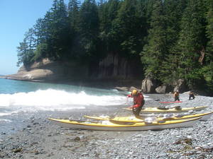
We eventually work our way down to Guise Bay, the first large bay on the west side of Cape Scott. It is Experiment Bight on the north side by a 1000 yard long canoe drag, an area of low sand surrounded by a beautiful meadow. In particularly rough conditions, one can portage one's kayak around the cape across this section. In the late 1800s and early 1900s, some Danish settlers tried to live here, but the lack of a protected cove and lack of a promised road to the site eventually drove them away.

A path with boards laid down as if it were a wagon trail leads up the lighthouse through a forest. We can see the three islands that compose the Scott Island group, five miles out. We imagine kayaking out to these islands, but that is a serious undertaking for some other day. Tomorrow we will head south and east for the first time, back towards home.


Day 16: Guise Bay to Cormorant Point

The weather today was good but windy and sporting, and very frustrating for me. With his skeg, hull length and natural ability, Scott always stayed way ahead of us, while I floundered in the quartering wind. I finally gave in and used a rudder stroke every fourth stroke to keep me from broaching. I'd really like to have a skeg right now. When the weather is fair, winds tend to build from the northwest, which will propel us down the coast. Tomorrow's forecast calls for a southeast gale, though, and the swell height off of Brooks the next couple days is 8 to 11 feet -- big weather ahead.

Day 17: Cormorant Point to Lawn Point

Wanting to cross Quatsino Sound, we got up at 4am to beat the gale. There was absolutely no wind crossing the sound until the last half mile, then winds kicked up to 20 knots abruptly. We are cold and wet as we stop for a snack at Restless Bight. I managed to rip the gasket on my drysuit (the party hasn't begun until someone rips a gasket). Roy gave me the idea of putting my Paclite top over my drysuit, then putting my balaclava hoodie on top of that to seal everything up, so no need to pull out the duct tape just yet. This setup also kept me plenty warm on a fairly miserable day.

We battled 20 knot winds to Lawn Point, and conservatively decided not to push on when we would be fighting the winds directly. We stopped at 1pm.

Today was not my day for several reasons. I was not be able to find my bear bags this morning for five minutes until Roy came over and pointed them out to me. I had put my food in spectra Ursacks and tied them to a log, but then I couldn't remember which log and was just not seeing straight.

Not to mention, my boat floated away. By fortuitous circumstances, disaster was averted, however. Scott had put his food in his boat and turned it upside down, saying that if something tried to get at it, we would be able to hear it. Then, Roy started hearing a banging in the night, as if some critter were trying to get at Scott's boat. He looked out, but Scott's boat was fine. Then later, he heard the banging again, and a screech. Again he looked, but Scott's boat was fine. The other boat was fine, too. But wait, weren't we supposed to have three boats? The other one was floating in the bay, 50 yards away. Roy called out the alarm, and I said that whosever boat it was would have to get it, until I realized it was my own. We should have been more careful tonight, as it was the highest tide of the month and the logs on which we place our boats where themselves floating and bumping against each other (which was causing the banging sounds Roy had heard).

This evening I listen to the rain coming down. I set up my siltarp as a vestibule for my tent, and am quite comfortable. I can hear the wind blowing over the trees, but our camp is tucked in the lee of the wind. Welcome to the west coast.


Day 18: Lawn Point to NE Brooks

High tide last night rocked a few more logs near the tents. Roy had marked the afternoon high, then using a cup of water as a level, eyeballed where a two foot higher tide might go, and we were supposedly safe. We got up at 4 am again.

We rounded Lawn Point and entered Brooks Bay, one of the most beautiful bays on the west coast. The Brooks Penninsula looked like the Misty Mountains, and later, the mist descended onto the bay to reduce visibility to a half mile or less.

We saw a tarp set up on First Beach (aka Beach of the Lotus Eaters), but we didn't stop, and headed out to Fourth Beach, the furthest reasonable spot on the penninsula. Our camp is right by a river that looks like good surfing practice at the entrance. Sandpipers are running up and down the sandy beach with the waves, eating bugs and flotsam. They all turn as one and race back up the beach as a new wave comes in. I bathed (ahh) in the river and did my laundry (ahh), erroneously thinking that we would have dry weather at some point to dry them out. In a fit of twisted logic, I ended up wearing my clothes in order to dry them. The weather report says tomorrow's winds are going to be 20 to 30 and swell 8 to 10 feet, so we will wait until Friday to go around the Brooks. Rest day! Actually, I've gotten accustomed to long days, and the last couple days have seemd like days off, almost.


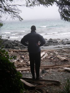
Day 19: Rest

It rains all day. My tent leaks in spots at the seams with the silnylon floor, so I use my pack towel to keep it dry. I venture outside once or twice and take naps. Scott reads his book. I'm worried that Roy has gone missing until he finally makes a brief appearance out of his tent in the early afternoon. I'm pretty comfortable considering it has been raining all day and all week. I'm ready for sunshine, though.

Scott and I make a brief foray down the beach. We had to cross the river which was up to our knees. Bibs work nice for this sort of stuff. Back to the tents for another nap. We call Andrew on the satellite phone and let him know that we are going to be going around the Brooks tomorrow. We agree to meet him at Rugged Point on Sunday at 5pm, three days from now, so he has a little time to get himself in position.

Day 20: NE Brooks to Nasparti Inlet

Today is the big day. Swell height is still big, but forecasted winds are down. The surf is still big coming onto our beach, so we aim to launch out of the river. Roy, the last one in, has trouble with the hydraulics pushing him onto the rocks, and his boat gets battered a bit. Luckily, he knows a good fiberglass repair guy back home. After a few aborted attempts off the beach, he moves his boat into knee deep water, jumps in, and paddles out through the waves without his sprayskirt on.

The wind out at Cape Cook was mild, maybe 7 to 10 knots. We paddled out to Solander Island where the puffins flew and the sea lions bellowed. The channel to the north of Solander was constantly breaking with white water and the sea lions were looking at us warily, so we opted not to go around the island, instead just staying on the inside. Mist came in and dropped the visibility to a half mile, which was about the distance offshore we were as we contoured around the penninsula. The swell was a little too big to venture in closer. We made no stops. We went very wide around Clerke Point where there were a lot of breakers into kelp beds.

Day 21: Nasparti Inlet to Spring Island

Today is a sightseeing day, as we keep ourselves entertained while allowing Andrew a little extra time to get into position. After a little rain this morning, the weather clears and it turns into a beautiful day. Our stormy days are finally over, and as it turns out, we will only get a sprinkling of rain once during the next two weeks of beautiful weather.

We head for the Acous Penninsula where we see the burial island with the skull and canoe again. Scott points out a location where there are lots of shrubs and small trees above a beach and suggests that as a likely village site due to the atypical nature of the flora. It suggests that the old trees were cleared at one point and different species grew back. Checking it out, we found the long house we were looking for (go Scott!) as well as two fallen totem poles.

We met a solo kayaker who was headed out towards the Brooks. Roy scoffs at the kayaker without immersion clothing and with paddle float on back deck, suggesting the guy would not know how to use it in the wind/waves. We are such elitists. Anyways, it's lucky that people don't flip over very much***.

We visited Battle Bay next, where there is a nice beach and a river coming out. A beautiful grassy meadow surrounded the river for a distance inland. Perhaps the river gets flooded with brackish water at high tides so no trees grew there.

Next on our tour guide is a quick trip through the Bunsbys. We continue on to Thomas Island for a nostalgic visit to our crash landing there during last year's storm, but we don't land this time as it is too marginal. Then, on to the Mission Group.

Realizing that on Sundays the stores could be closed in Kyuquot, we decide to pop into Kyuquot this evening, arriving at 5:30. We find that Charlie's is closed for the season (perhaps permanently), but the general store is open for another half hour. We have a junk food feast, make a few phone calls to loved ones, and watch the native kids play tag and dive off the dock.

Heading back to the Mission Group, we discover that Aktis island is an Indian Reserve with houses on it, and that Kamils island has a nice looking beach, but the meadow above it ends up being a graveyard. We head to Spring Island. There are some fishing camps on the islets around Spring, and a couple camps in the large cove, but we find a spot to call our own. We are not used to sharing spots with other people.

***: Upon arriving home, however, we discover that this kayaker had been reported missing the following week, and that he and his kayak were never found.