Sunday, July 18, 2010

Devils Backbone

With a name like Devils Backbone, I expected the run to be difficult, but it took a little more out of me than I thought. I had heard good things about the run from Matt Hart, a strong ultra-runner, so when Chase asked me in January if I wanted to go to Bozeman for the 50 mile trail run, I signed right up. It was a good thing, too, as the mid-July run, which allows only 30 solo entries due to Forest Service permits, filled up in February this year.

Tom McGoff Hayes confirmed our entries and told us that "this is not a normal trail run. You will be carrying more weight since you will need food and water for at least 5 hours (more likely eight to ten hours) until the one and only aid station. You will also have to feel confident navigating mountain ridges and meadows with no ribbon showing the way... This definitely should not be your first 50 miler." Not to mention, most of the trail was higher than 9000 ft above sea level, making it even more difficult for us low-landers.

Chase and I drove out together to Bozeman on Thursday and crashed in the living room of his friend Peter for the long weekend; Peter also graciously provided us with a beaten up old tandem bike to ride around town so that we could take in the sights. The sun beat down on us with temperatures above 90; Saturday was going to be a little cooler, however. I tried my best not to burn to a crisp before then.

We attended the pre-race meeting on Friday in Tom's backyard, where I sized up the competition. Two guys from Utah, Jay Aldous and Leland Barker, had both finished in the top 5 at Hardrock in previous years, and were the contenders to win. Another runner, Christian Johnson, had run Devils Backbone last year in 10:30, which was my goal for running this year, so I thought I should watch for him and try to tuck in behind him. Tom gave away a bunch of prizes from sponsors to all the attendees, fed us a pasta dinner, and gave us a few pointers about where we could go wrong on the totally unmarked course the next day. He provided some hand-drawn maps as well that showed key turns; I also had topo maps that I had printed out from his website, so I felt pretty confident about staying on route.

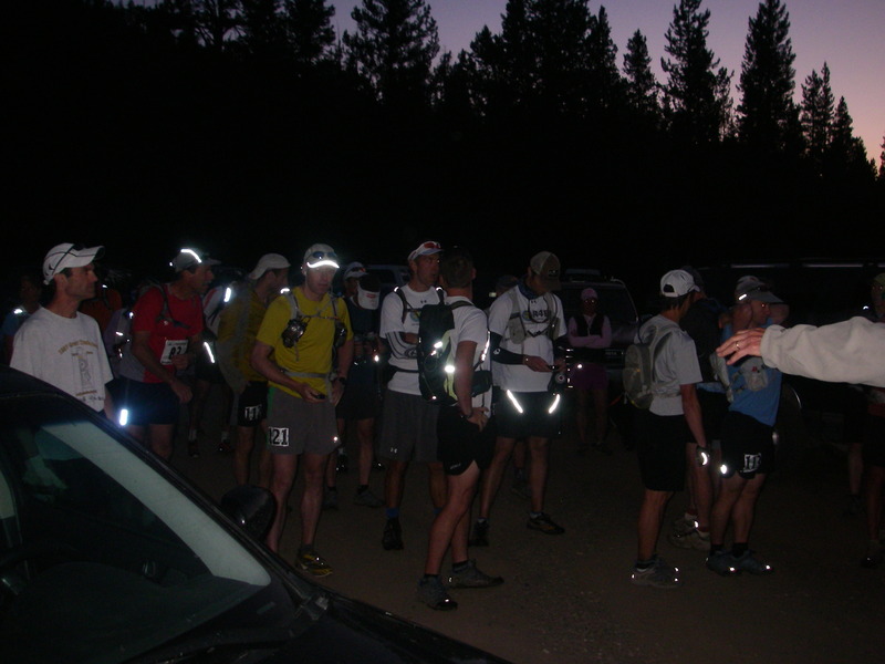
Chase and I woke at Saturday morning at 3:30am and fueled ourselves up with breakfast and coffee, before heading out the door to drive for 45 minutes up to the Hyalite Creek trailhead where the race started. Just as dawn broke, Tom started us off and pointed us down the unmarked trail, which climbed 3500 feet in the first 7 miles to the top of Hyalite Peak at 10,300'. Immediately into the run, I could not keep my breathing under control, and settled into as relaxed a pace as I could given the altitude. Leland, Jay and Christian all immediately disappeared around a turn ahead at a solid run which I knew that I could never match. Five minutes into the race, I had already gotten dropped by the fast guys.

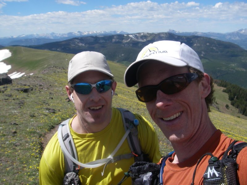
Chase and I ran together as we powered through the climb at a good, steady pace. He was looking strong, and when he stopped for a quick bathroom break, he managed to sprint back up the hill to catch up with me. We entered the bowl below Hyalite Pass to see the several hundred foot tall snow slope that we would have to climb to reach the pass. The front runners were already gone, and Chase kicked steps up the slope to reach their tracks while I followed in his footsteps. We looked to see runners behind us hiking slowly up the slope like little ants. Sidestepping the cornice at the top, we were over the pass.

On the way out, we summited Hyalite Peak and grabbed a poker chip from the bucket at the top to give to the race director at the turnaround point. The peak was only a few hundred vertical feet out of our way, and we were quickly up atop it, then back down to the trail that snaked southward along the ridge as far as our eyes could see. Only the occasion snowpatch on a north slope hindered us; the ridge was almost completely snow free. Rocky trails, on the other hand, hindered us, and the altitude definitely did as well.

The Devils Backbone ridge lasted forever. We didn't have much perspective about how far we had gone based on our map. Ridges led to ridges, and the ups and downs slowly ground away at us. The ascent and descent seemed so much more difficult than mere numbers would suggest. We both suffered from lack of acclimitization, and even the milder ascents seemed daunting. My stomach started to protest, and I didn't feel like eating anything.

I imagined that we would reach the aid station/turnaround point at Windy Pass cabin after 5 hours or so, but the five hour mark came and went. I ran out of water so I borrowed some from Chase, who seemed to be drinking much less than I was. Another 10 minutes went by and we passed the front runners returning from the turnaround, looking strong. We descended off the ridge and pulled into the cabin at about 5:25 or so, far slower than expected. I decided to take it easy on the way back and try to get the most enjoyment out of the race rather than try to push too hard and suffer.

I loaded up on water at the aid station: a full 100 oz bladder and two 20 oz hand-helds, then headed back out, waiting a few minutes to take some pictures though while Chase caught up. We started hiking back up the hill. Such a moderate ascent, but we were beat. On a very runnable downhill, I had sudden GI pain and peeled off to the side of the trail to relieve my discomfort, losing Chase down the hill. After I had resolved my issues, I continued on, and found Chase coming back to look for me, worried that I had twisted an ankle or something. Then Chase started to have his own issues, vomiting in one case after gagging on some electrolyte drink.
We were far away from anywhere now, and the only way out was to keep running. We slowed our speed down a notch and kept plodding along. A strong wind blew across the ridge, teasing our caps from our heads; however, it kept us reasonably cool and dry as sweat evaporated instantly from our skin in the sunshine.

When we finally passed Crater Lake (a small stagnant pond), Chase bemoaned that we still had "two more maps to go". I tried to encourage him that most of the climbs were behind us. We saw nobody ahead of us or behind us. We felt alone on an interminable series of ridgelines. Hyalite Peak eventually came into view, a thin ascending line crossing its flank to the pass that marked the trail we would follow. We attained Hyalite Pass almost 11 hours after we started, and gazed down the steep snow slope on the north side of the pass below us.

The race director had told us to take a flying leap at this point, so we did. The snow was soft in the afternoon sun, and we glissaded easily to the bottom of the bowl. Reinvigorated by the cold snow and the 3000 foot descent ahead of us to the finish, we perked up and started to run like we really meant it. Chase thought that we might break 12 hours at one point and we attacked the descent with renewed vigor until the 12 hour mark had passed, then we settled into a comfortable pace for the last 15 minutes to the parking lot. A couple volunteers were lounging at a camping spot in the trees, and let us know we could stop running now. Whew! After 12 hours and 14 minutes, we were certainly glad to be done. That was a hard but beautiful race. Now pass me a turkey, cheese, pickle and mustard tortilla wrap, please. I'm hungry.

Monday, July 5, 2010

Yukon River Quest

The Klondike gold rush of 1897 found prospectors streaming up the coast to Skagway or Dyea, Alaska. From there, they hiked over Chilkoot Pass, down to Bennett Lake, and then they built rafts to float the Yukon some 500 miles down to Dawson City, located at the confluence of the Yukon and the Klondike. Andrew and I heard of a fabulous race called Yukon River Quest which gave us a similar experience, albeit a little more modernized. We decided to go for it.

Yukon River Quest starts in Whitehorse, Yukon (about 50 miles downstream from the Bennett Lake system), and ends in Dawson City. Our goal was to travel down this 460 mile stretch of the Yukon river as fast as we could. Andrew and I paddled a double kayak; others also chose to paddle canoes, voyageur canoes (holding 6+ people), and single kayaks (they get my respect). Everyone started at noon on Wednesday (June 30), and needed to finish in Dawson before midnight on Saturday night, 84 hours later. However, with mandatory rest breaks at Carmacks (7 hours at milepost 200) and Kirkman Creek (3 hours at milepost 362), we had 74 hours on the water to complete our task. Except at Lake Labarge, a 30 mile long lake a few hours out of Whitehorse, the Yukon river was flowing at a reasonable clip, so our main goal was to stay on the water as much as we could and paddle with reasonable effort.

Our first goal was to get to Whitehorse, however. I drove to Vancouver and caught a flight to Whitehorse on Air North, where I relaxed amongst the amenities that this town of 25,000 had to offer. While small, this town contains two thirds of the inhabitants of the Yukon; Dawson City ranks second largest at about 1,500 inhabitants.

Andrew drove up. He really wanted to bring a fast kayak, and because we had not signed up immediately, the rental companies in Whitehorse had only barge-like boats left for rent. His kids had studied the Gold Rush in school, and so he brought the family and turned the trip into a "fun-filled family vacation road trip", at least so much as a 4000 mile roundtrip drive through barren wilderness can be called that. Our rental from Popeyes Marine and Kayak Center fell through (don't ever rent from them), so we scrambled for an available boat, and we ended up buying one on Craigslist from a place near Nanaimo, with Andrew to pick it up on the way up to Whitehorse. They listened to "Call of the Wild" book-on-tape along the way to get themselves in the appropriate mood for the Yukon.

Together at Whitehorse, we shuffled gear, went grocery shopping, and attended pre-race meetings and gear checks. Come Wednesday, we place our boat along the riverbank next to 75 others, and we waited for the start in unforgiving cold and rain. While temperatures had been in the 70s under a blaring sun all week, Wednesday brought grayness, wetness and coldness. I put on my gortex bib, paddle jacket and gortex hat. I was happy that I could wear them without overheating.

The horn sounded and the race was on. We ran 200 meters across the park to our boats, then pushed off into the Yukon to start the race. I had never been in our boat before, and I discovered that I needed a little practice with the new-fangled rudder system. We almost took out a photographer standing on a submerged sandbar before I veered out into deeper, faster water. I tried to draft the person in front of me, but I zigged and zagged and could not control the turn of my boat. The voyageur canoes came up behind us like semi trucks, and I veered out of their way. Many other canoes and kayaks shot past us on their way down the river. We lagged. I'm sure I'll figure out this whole rudder thing in a few more hours. We have lots of time to practice.

For three hours we travelled downriver to Lake Labarge. As we made our way onto the lake, the wind built up two to three foot wind waves that quartered us from behind. The kayak zigged and zagged and we started to successfully surf a few of the waves, especially after I tightened the tensioning straps for our rudder. Now in our element, we elatedly passed several teams ahead of us. We made one quick stop along shore to retension the rudder straps, but otherwise we planned to stay in the boat. We passed a couple more teams at 9pm at the end of Lake Labarge who were changing into their night clothes. Our gortex bibs were fine for the night, and we had cagoules to throw over us if we got a little too chilly, which we eventually did.

The Yukon twisted and turned snake-like through the Thirty Mile River section, a 30 mile stretch between the end of Lake Labarge and the confluence with the larger Teslin river. I felt like we were moving slow, although we were making a reasonable effort. I convinced myself that our boat must be slow, and that made me feel a little better. The current always looks better on the other side of the river, and I spent a little too much time wandering back and forth across the river to find the fast current, which never seemed to be there once I arrived.

As we rounded a curve after the Teslin, I saw my first beaver. Only 10 yards away on the bank, it looked like a furry basketball. On three more occasions in the trip we saw beavers along the edge of the river, all gathering small branches and twigs for their beachside cottages. We never saw a single deer, elk, moose or bear, which surprised me a bit. Beavers own the Yukon.

We followed our laminated charts as the river curved this way and that way. We had twenty pages of charts to get to Carmacks, and we seemed to go more and more slowly through them as twilight came. While the light never faded past twilight in the midnight to four AM hours, it still took a toll on our senses, and we continued to grow sleepier as the morning hours crawled past. Andrew took a catnap in front to reinvigorate himself. I tried raising the rudder so that Andrew could steer while I dozed, but we promptly turned sideways and rammed the shore. Note to self: back person needs to steer at all times. How dismal.

At our lowest low, we stopped in order to quickly switch places. I tried to nap in front, but I could not relax, as I felt I was going to pitch sideways into the water. We stopped again to switch back. However, this extra movement plus a few coffee beans woke me up enough that I could keep going without falling asleep. We finally pulled into Carmacks exactly 24 hours after we started, hurt and tired.

Volunteers helped us in Carmacks by setting up our tent, drying some of our clothes, and filling up bladders with water. We ate burgers, milkshakes and french fries at the canteen, changed clothes, mindlessly rushed around doing tasks I cannot remember, then went to bed. I could not sleep at all due to a horrible pain in my left shoulder, but after some ibuprofen, aleve and melatonin, I calmed down and slept for four and a half hours.

We arose early and got ready to leave exactly seven hours after we arrived, which included drinking another milkshake. We resupplied with food and left a few extra unneeded things in our Carmacks bag, which would get shipped on to Dawson for us. After a quick gear check by the authorities, we went down to the dock and launched back onto the water for another 18 hour spin until the next rest stop. Another double kayak was only seven minutes behind us; we felt some pressure to keep up our pace to prevent them from catching back up.

On the water, my muscles and tendons complained much less than I had expected, and my fears subsided from the previous night of being unable to continue. Time flew and soon we came upon the first of two rapids: Five Finger Rapids. We stayed right as instructed, and with a few bumps we were through. Looking back, the other channels also did not look too bad, either, so conditions must have been miild. A half hour further on, we sidestepped Rink Rapids by also going right. These were the only two sets of rapids that we needed to worry about, and they weren't much. A more prevalent danger, however, was gravel bars that dwelt just under the surface of the river. We occasionally ran into strong side currents that pulled us over very, very shallow bars and threatened to ground us if we didn't paddle hard to get away from them.

We travelled past Hells Gate Slough stretching out in channels to our right while the main current shot quickly along the left bank. Shortly thereafter we passed Fort Selkirk, a historic trading post that was abandoned in the 1950s when the Klondike highway bypassed it and Yukon river traffic died down. At the checkpoint here, we called out our team number as we passed. Another team on shore played with their gear, and we quickly left them behind as we cruised along in the 5 mph current.

Many islands now dotted the Yukon river, and channels and sloughs weaved between them. Although we typically followed the main channel, we occasionally darted down small channels that cut more direct paths around a curve when the main channel swung wide. In general, we discovered that the shorter path was usually the better path.

After 18+ hours and only one five minute stop along the way, we pulled up at Kirkman Creek, a primitive campground without road access that was the site for our second and final rest break. We filled up with water in the stream, ate soup and sandwich, and then spread our sleeping bags out on the lawn for as much rest as we could get during this three hour stopover. Five minutes later when it started to rain, we moved into a couple of tent shelters that they had provided, although the rain splashed through the mesh of the tent and soaked my bag before the storm cloud passed. I did manage a good solid hour of sleep. We ate some very expensive cheeseburgers and got back on the water exactly three hours after we had arrived. At this point, another double kayak was 20 minutes behind us, and a solo kayaker and solo canoer were only a few minutes ahead of us. We felt reinvigorated.

Seconds after we got on the water, a squall came through and a storm dumped on us. I threw on my cagoule. The solo canoer had pulled to shore and we lef t him behind. Shortly thereafter, the solo kayaker ahead of us decided to take a shortcut through a sandbar, and we left him behind as well. He was navigating solely with his GPS, which seemed fairly difficult. Andrew and I each had a detailed river map, and together we came up with a plan on the most efficient course down the river. Alone, trying to look at a map on a 4" by 2" screen, I would have been much more confused about which islands were which and what channel went where. Andrew and I started doing "tempo intervals" - we paddled reasonably hard for 20 minutes every hour - so that noone behind us would be able to catch up again. We never saw another paddler again until the end of the race.

A couple more squalls came through, along with thunder and lightning. We battled a strong headwind for a time, and it reminded me why double kayaks are called "divorce boats". Every lift of Andrew's paddle brought a windblown splash to my face. My hood up and my cap down low on my head, I gradually fell into a repetitive head-tipping motion in order to block the spray while taking occasional peeks at the map to keep us on track. We had just passed the confluence with the White River, and gravel bars and submerged trees peppered the river. We could hear the grit and gravel grinding against the hull of the kayak, and the water was opaque and churning. Lightning struck again, ahead of us. I became a little worried.

The river turned in the opposite direction of the thunderstorm, however, and gradually grew deeper and less angry. The current moved us quickly along, and before we could count to a billion, we saw the Moosehide Slide marking the hill above Dawnson City. Although I joked about arriving at Dawson when the bars closed at 2am, the skies of the "midnight sun" looked like a Seattle afternoon. We pulled into Dawson City in fine spirits, changed out of our wet gear, and headed to our hotel where Andrew's family was sleeping. We'll come back and pick up our kayak later. It's time for bed.