 but given how hard it is to get into the race through the lottery system, I may never get the chance. Instead, I decided to plan my own run-cation to go run/hike the course in four easily manageable segments over four days. Along the way I would travel 100 miles, accumulate over 33,000 feet of climbing, and summit Mt Handies, a 14er. My dad and Karen signed on to be my crew, and would drive our car to meet me at each stop.
This was the schedule
Thursday: Ouray to Telluride: 16.2 miles, 5500 ft gain, 10150 feet avg. elevation
Friday: Telluride to Silverton: 27.8 miles, 10200 ft gain, 11023 feet avg. elevation
Saturday: Silverton to camp Sherman: 29.3 miles, 9350 ft gain, 11430 feet avg. elevation
Sunday: Sherman to Ouray: 27.9 miles, 8000 ft gain, 11080 feet avg. elevation
We started from Ouray on Thursday. My father joins me on the trail to Telluride while Karen drives the car around. Warren is getting ready to run the Imogene Pass run in a couple weeks, and he has planned to get in a little high altitude training.
 The Hardrock course follows the same route as the Imogene Pass course from Ouray up to Camp Bird, but then we turn up Yankee Boy/Governors basin and go up and over Virginius Pass at 13100 feet. Virginius Pass is a steep scramble up scree to a low point on the sharp ridge. It is not be very runnable. At least we don't have snow and cornices like the acutal Hardrock race might have in the beginning of July; on the other hand, snow might be softer and easier than sliding backwards on sharp, pointy rocks. The descent into Telluride is straightforward.
My father drops me off the next morning at 7:30am at the trailhead in Telluride for my run to Silverton. He and I have backpacked this section on a two day trip in mid-September last year. We braved constant rain and dodged thunderstorms, and an overnight snowstorm dumped an inch of new snow on us. This year, on the other hand, the weather is perfect: daily highs in the 70s and continuous clear days. As I start my run this morning, though, the temperature hovers near 40 degrees, and overnight it dropped down to freezing in the mountains - I definitely do not want to be caught out overnight.
Praying for a healthy trip, I set out for Oscars Pass on a steady climb to 13,100 feet along roads then trails up a valley behind Telluride's ski slopes. From there, I drop down steep jeep roads, losing most of my hard fought elevation gains, then immediately head up again to
 Grant Swamp pass. This section, and Grant Swamp pass in particular, is one of my most grueling sections of the run. The upper valley is filled with scree, and at the top, I must climb a headwall of dirt and scree to reach a break in the rocky spires. I've only been at altitude for two days, and hour upon hour of high altitude exertion is slowly depleting me.
Beyond Swamp Grant Pass are picturesque Island and Icy lakes. Here I encounter Warren and Karen, who had hiked up Icy Lake trail to meet me. I shar a sandwich and a moment with them, then I continue on. Crossing a creek on an animal trail, I then follow a traverse across steep hillsides down valley to the next climb. I break out of the woods onto high grassy slopes,
 where I travel off trail over ridges to another high pass and down into Bear Creek valley, eventually picking up a hiking trail that I follow back down into Silverton. I finish at 6pm, just in time for a delicious prime rib dinner at the Pickle Barrel in Silverton with the family. That was a little tougher than I thought it would be.
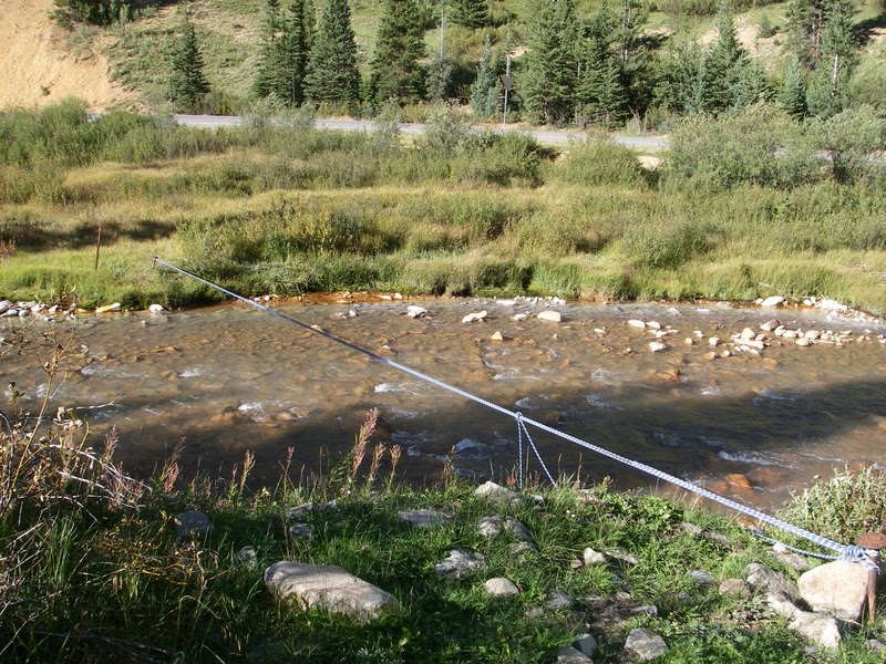
The next morning, I become a little anxious thinking about my run. This leg from Silverton to Sherman is slightly longer, higher elevation, and has more off-trail mileage than yesterday. I am unfamiliar with the route, and I also planned to meet my father and Karen at a wilderness campground at the end of the day. What if one of us doesn't make it there? Looking at the frosty ground, I don't relish the idea of being outside at night without a tent or sleeping bag. I pack an extra layer of warm clothes in my pack, and a headlamp, just in case something dire happened.
As I head out of town, I pass the giant canopy tent for the Silverton 6-day, 3-day, 24 hour run that is going on up and down Kendall mountain. This bunch of crazy people is running a one mile loop up and down the mountain, over and over and over. I prefer to travel, and I will hopefully end up in Ouray, where I originally started, two days from now. After a couple brief navigational issues, I find the correct jeep road and head up, up, up to the first pass of the day:
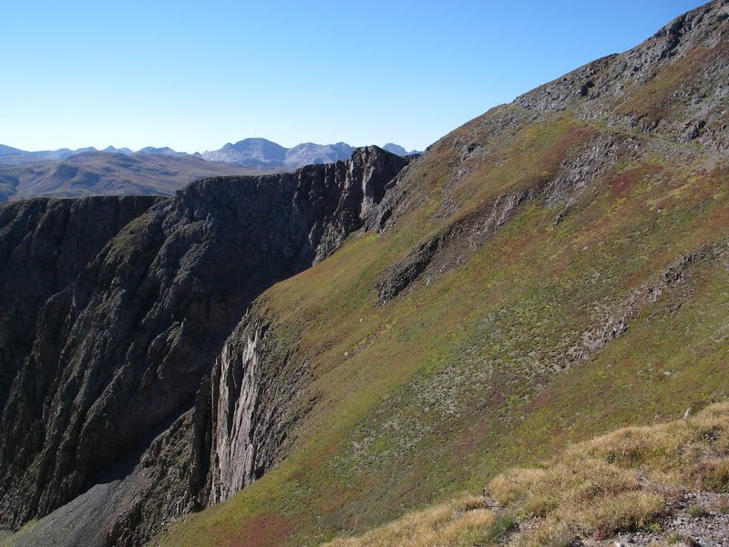 Little Giant Pass. The course description reminds me that a slip on the narrow trail cut into the rock here could be fatal; however, the trail is dry and free of snow and easy to travel. After my brief visit to 13000 feet, I drop into Cunningham Gulch, switchbacking steeply down through a scattering herd of sheep in the lowlands, then across the road and up the other side.
The trail up to Green Mountain Pass diagonals up steeply between cliff bands, then follows a ridge into a valley up in the higher reaches of this range. At some point I am supposed to turn left on a vague secondary trail and ascend slopes to a pass, but I do not see the trail. After a little puzzlment, I pull out my topo map and forge out on my own course. I find the pass, then traverse slopes to a 4WD road through Stony Pass. The four-wheelers are out today, enjoying Labor Day weekend. I am quickly across the road, however, and ascend slopes to a small peak at 13200 feet, the high point of the day. A short contour takes me down to Buffalo Boy Ridge.
I have gone only 14 miles in 6 hours, so I am currently on the 12 hour plan, giving me an hour of sunlight left after my arrival at Sherman. This high altitude stuff is killing me slowly, as I find myself walking some of the flat sections above 12000 feet, not to mention all the uphills. However, most of the climbing is over, so I hope to pick up speed in the second half of the day. I try to call my father and let him know how I am doing, but there is, as I expected, no cell phone service.
Next, I drop steeply down a trail into Maggie Gulch.
 Once in the basin, I again have problems with the course description. After wandering around the basin for a short bit looking for a sheepherder's camp, I give up and strike out on my own again, descending the basin through open fields and light brush to the drainage at the bottom, where I cross a stream and arrive at the end of the 4WD road marking the location of the hypothetical aid station. On this run there are no aid stations, so I carry my food for the whole day with me. I do need to refill with water soon, however. Given the evidence of mining activity immediately around me, I decide to wait until the next stream.
Next, I climb up slopes and intersect with the Continental Divide trail, which takes me easily to the next pass and on into the Pole Creek drainage. The trails are becoming easier to follow and very runnable, although somehow I still manage to follow a trail that disappears on me a short way into the drainage. I can spot the correct trail nearby, and so I easily traverse over to it. Daylight and open spaces makes correcting my course fairly easy. Now I glide along, slowly losing altitude down West Pole Creek basin to the confluence with the main fork of Pole Creek. I hike and occasionally run as I slowly gain altitude up the main fork of Pole Creek.
My last climb is off trail and over the pass into the Cataract Creek basin. Once again, I cannot quite follow the directions of the Hardrock course description, so I bushwhack up to the correct area.
 I am glad I have USGS 7.5' quads of the area, as I feel confident about finding my way irrespective of the trail description. I work my way through heavy bushes and come out a the pass, where there is still a Hardrock trail marker dangling from a cairn. Hooray! It is all downhill from here.
The last five miles takes me past a few serene lakes, then down Cataract Gulch. The more I descend towards the trailhead, the more well-defined and easy to run the trail becomes. I make very good time, arriving at camp Sherman at 5:30pm, 10.5 hours after
 I left Silverton. I had spent a non-trivial amount of time on this leg wandering around trying unsuccessfully to figure out the exact course description. Tomorrow will be much easier. Warren and Karen, the great crew that they are, have already set up my tent and are making me dinner. Yum!
Sunday is my final leg.
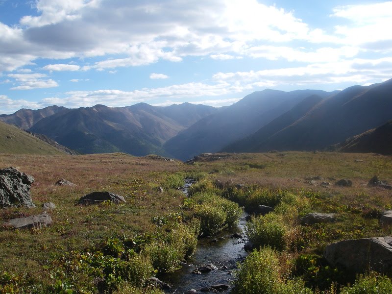 After a delicious pancake breakfast, I say "see you soon" to the family and I set out for Ouray. I make good time up 4WD roads to a trailhead and turnoff to Handies Peak. A small village of people are camped here, ready to climb a 14'er. The trail up Handies is very well established, and I can put my maps away and just speed-hike along, up, up, up to the basin below the peak, up a ramp, up the ridge, then over the top, still on the well-established trail. At least a dozen people are already at the top this morning, and I passed many more on my way up. It is a bit windy and crowded on top, so I take only a minute to enjoy the view, then I turn south and cruise down the other side of the peak into American Basin.
A faint side trail leaves American Basin and takes me over American-Grouse Pass into Grouse Gulch. I lunch at a small lake in the upper basin, then follow an established trail down the valley to a 4WD road. I don't really look forward to the 5 mile run/hike up the road to Engineer Pass on the Alpine Loop, a popular 4WD circuit. Jeeps, motorcycles, and little
 4WD buggies pass me in both directions constantly as I continue up the road. The scenery of the valley below is amazing, however,
  and I can understand why everyone and their mother would want to be here.
At Oh Point (it is named such because people look at the view and say "Oooh!"), I wave at the gaggle of jeepers enjoying the view, then I dive over the edge and into Bear Creek basin. No 4-wheelers are going to follow me here. I skirt a huge herd of sheep that fills the upper basin, picking up a trail lower down that will take me all the way down to the highway six miles away. This trail is beautiful as it drops into a narrow walled valley past a couple old mine sites, then skirts along the walls as the edge drops precipitously down to the stream bed hundreds of feet below. At the hanging valley's mouth,
 I drop steeply down shale-covered switchbacks to the highway just outside of Ouray.
I travel trails that weave back and forth between the highway and the Uncompaghre River as I descend into Ouray, then I turn onto city streets for the last half mile to the city park. I finish at the gazebo where I started four days ago, take off my shoes, and soak my appreciative feet in the creek. I am home.

No comments:
Post a Comment