The Craggies (Big Craggy Peak and West Craggy Peak) are two peaks north of Winthrop that are among Washington's Top 100 Peaks. Susan Ashlock invited me along to scramble these two peaks on Wednesday, and despite the reported 6 to 8 inches of snow that fell in the mountains on Monday/Tuesday, I quickly accepted her offer.
After a long drive up from Seattle on Tuesday night, we stayed at one of the campgrounds out Eightmile Road, north of Wintrhop. An inch or two of snow dusted the road, but the campsite was bare. The temperature was definitely below freezing, however, and it was going to get colder up top.
We arose at 6am and got on the trail at about 7:15am, just as it was starting to get light out. The trail began as a jeep trail and eventually turned into a hiking trail, which was still easy to follow despite a few inches of snow over everything. The jeep trail/hiking trail did not seem to match the trail on the topo map, but it got us to the right spot nevertheless.
At 5900' we turned off the trail and headed up an open meadow, following the SE ridge all the way up to the peak of Big Craggy. As we got higher, we encountered deeper snow and some drifts, and the last scramble section was a more sporting due to the snow-covered scree that unnerved me a bit as the slope steepened up (I think that going much further climber's left would have been easier). I wallowed up a snow-filled gully trying to follow Susan's light steps, but we eventually prevailed through the steepest sections and followed the final ridgeline to the rime-covered cairn at the summit. The temperature was 21 degrees, but the winds were calm and the sun was even threatening to peak out on this gorgeous late October day.
From Big Craggy summit, we traversed the ridge and followed an easy contouring descent down open slopes to the saddle between the Craggies that was only made easier due to snow covering the scree. We continued contouring along slightly more difficult slopes, occasionally bogging ourselves down in snowdrifts, until we reached a wide gully with access to the West Craggy ridgetop. We went up the gully to a notch, then up another gully to access the easier high slopes on the west side of West Craggy. The final climb up the gully was a bit tricky, requiring us to scrape the snow off of the rocks to find good footholds, and it was even trickier coming down (I let Susan show me her delicate balancing style coming down the snowy rock outcropping and I followed as best I could). An easy hike along the ridge got us to the top. The sun came out and we had beautiful views of the Pasayten Wilderness in all directions.
On our way down, we dropped down to Copper Glance Creek and followed the creek down to our original hiking trail. The snow drifted much higher down near the creek, and we alternately plowed through waist deep snow or dealt with tricky rockfields hidden under the snow that threatened to trip us up. Once back on the trail, however, we cruised the final couple miles back to the car, happy that we could enjoy a final trip to the mountains before the snows became too deep.
Total time: 9 hours, including 3.5 hours to Big Craggy, 2 more hours to West Craggy, 3 more hours back to car.
Wednesday, October 28, 2009
Tuesday, October 13, 2009
visualization works
When I go out to do an activity, I believe that I am more successful if I visualize it first, imagining myself doing the activity to a successful outcome. Yesterday, I demonstrated to myself the concrete advantages of this approach.
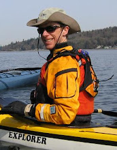
I decided to kayak around Bainbridge Island. I got my stuff together and started to drive over there. On the way I imagined myself kayaking around the island. I pictured myself in my drysuit with my paddle... paddle? I had to turn around three blocks from my house because I realized that I had forgotten to grab a paddle. Thankfully, I discovered this before I got too far. That is the power of visualization.
I paddled out from Golden Gardens, and looked south to West Point. There was lots of smoke coming out of the smokestack on the lighthouse on West Point, which looked really odd. I thought something was wrong, and when I looked again a minute later, I confirmed it. The lighthouse had moved around the point - it was actually the superstructure of a large tanker ship coming up the channel at me. I stayed in the lee of West Point while it crossed 200 yards in front of me, then continued my crossing to Bainbridge.
Lots of wildlife today. I saw a group of about 8 harlequin ducks in there fall plumage - very beautiful. I also saw something the size of a whale, but which I believed was a large sea lion offshore of me. As I paddled on, I kept looking back, expecting to see it following and harassing me, but it did not resurface. I don't like sea lions.
At the south end of Bainbridge, I looked at my watch and realized that I had taken 2 hours and 45 minutes instead of the 2 hours that I had expected. I wasn't sure why the discrepancy, but decided that it was best to put of the Bainbridge circumnavigation if I was going to be slower than expected. I did not want to recross back to the mainland in the dark, and there were no real bailout points once I started going around the backside of Bainbridge (Kathy was out of town, too). I will do Blake Island instead.
I started to head to Blake, but all of a sudden, a (the?) sea lion appeared 10 yards off my bow in a huff. I immediately turned around and headed for shallow water. Looking back, I saw three sea lions now cavorting where I had been. Were they all following me now? I decided to continue along the shoreline around Bainbridge. However, after another 10 minutes, I changed my mind again and headed towards Blake Island. Expected east winds also added to my concern about being stuck going from Bainbridge back to the mainland late in the day.
I circumnavigated Blake, stopping at the Cascadia Marine Trail site there to check it out. The Cascadia Marine Trail was set up to provide camping for human-powered beachable watercraft (e.g. kayaks) in the Puget Sound, and there area special campsites in a lot of locations to help out all you kayak campers out there. After Blake, I kayaked back to West Seattle, then around Alki point and back towards downtown Seattle.
I wanted to get across to Magnolia, but there was a lot of boat traffic to navigate, as well as a 2 foot chop from the 10-15 knot east winds that had finally arrived. Ferries regularly travel between Seattle/Bainbridge and Seattle/Bremerton. Additionally, not one, but two cargo ships decided to head into the Port of Seattle right when I wanted to cross, so I had to wait until all the boats cleared out. When I made my dash across, I was stopped short by a Coast Guard cutter that was also waiting for the other boats to clear out. I felt like I was playing frogger.
Once I made it to Magnolia, I had an easy cruise along the coast back to Golden Gardens, arriving 7 1/2 hours after I left. I got in a full day's work after all. When I got home, I re-measured the distance around Bainbridge and discovered that it was 11.5 miles down to the south side of Bainbridge rather than 8.5 as I had originally thought, but that the overal distance around Bainbridge (35 miles) was not any longer than I had originally thought, so I would have been on schedule after all if I had done the circumnavigation. Next time. As it was I had a good tour of Puget Sound and got in a long day's kayak on a nice fall day. No complaints here.
Sunday, October 4, 2009
Sams Wonderland Video
Sam posted a nice compilation video of our Wonderland Trail trip. We looked kind
of tired at the end. See here.
Big Tahoma Rogaine
Andrew and I were going to participate in the 24 hour Big Tahoma Rogaine down near Mt Rainier, but Andrew hurt his hamstring last week and had to stay home. I'm a bit burned out on everything else I've been doing, so I looked forward to doing the 6 hour event solo (solo participants can do the 6 hour event, whereas teams may do the 6/12/24 hour events).
I got up too early on Saturday morning and drove down to Ashford and up the forest roads to the event start, which was in the same location as the Fall Beast race last year. Eric Bone showed up customarily late with the maps, but we started within 10 minutes of the posted start time with a little less time to plan our route. The skies were clouded over and the temp was about 40 degrees, but the rain was supposed to hold off until Saturday night, not affecting us 6 hour folk. I decided to treat this as I would a 50km trail run, and brought just a windshirt and tights, hat and gloves with me. In hindsight, this was a mistake.
I planned an ambitious route that would cover 45 km or so and hit two areas that had some controls with large point values, with a place or two to skip a checkpoint if I was getting behind. Right from the start, it included a long climb to High Hut to get me warmed up, and after the first 15 minutes or so, I was in my t-shirt, hiking/running up the hill feeling good.
At the very first CP, I took off a glove to punch the checkpoint and write my name in the log. I was the first one there. Other people were following me, and in my hurry, I dropped my glove somewhere, realizing only a few minutes later. I would have liked to have that glove later on.
Everything went reasonably smoothly for the first couple hours, and I did very well at navigating to the checkpoints. The climb to High Hut was straightforward, and kept me warm with all of the frost on the ground and trees around me. I was especially happy when I navigated straight to CP 65, which required following a couple overgrown rides then bushwhacking to a "subtle hilltop". I decided to skip a 50 point CP in order to give me a little more time for the second half, then I ran into problems.
Checkpoint 64 did me in. It wasn't that hard to find, but required bushwhacking 300 vertical feet down a ridge across slippery logs. I fell three times in a row and my body was a bit unhappy. Going back up, I had to go 600 vertical feet back up the ridge to get to another path. The faintest trail was marked on the map, but I could not find anything and ended up heading through bushes that were completely laden with water from dew or the previous night's rain. In any case, I was soaked within minutes, and I spent what felt like a half hour thrashing around in the bushes, cold and soaked to the bone. My fingers stopped working; I was miserable.
I headed back to do the second loop in bad shape. The day was still cloudy, so I was not warming up much. My shoe got untied and I couldn't retie it. The strap on my thumb compass came off, and I could not rethread that either. Then I dropped my compass while trying to get some food, and only noticed it a short time later. I spent the next five to ten minutes hiking back and forth like a drowned rat packing, looking for my compass, shivering with my shoe untied. I was deciding at this point whether to fake a debilitating injury and call it quits when I spotted my compass on the ground. Not too much time lost. Maybe I would keep going, but no more bushwhacking.
I tried to find CP 43 which was off the road down a reentrant, but after a short effort, I turned around, as there was too much brush. Then I headed up for a long climb up and over a ridge. At one point, I turned around, deciding to call it quits again, but after hiking back down only 30 feet or so, I psyched myself up again and decided to continue on. Being alone brings out the difficult psychological battles in me, apparently. It would have been nice to have a partner to work with to keep me going strong.
After getting another couple easy checkpoints along the road, I got to an intersection where I could head up to some of the higher scoring ones, but I decided I did not have the time or determination to do so, and I followed another trail that would loop back to the start. I completely went past CP 23, which I thought might be easily visible from the road, but it wasn't. No turning back, though. At another intersection, I had a chance to go for a couple more CPs that were on side roads, but my will was gone and it had started to flurry, so I kept following the course back to the start/finish. I picked up a couple more CPs along the way back, then grabbed a couple easy ones near the start/finish before checking out in 5 hours 30 minutes. As I had run to the last couple CPs along the road, I had actually started to warm up by the time I got back, but otherwise I had been miserable for the last two and a half hours. I wrung the water out of my hat and called it a day.
It turns out that my 725 points was enough to finish in 2nd place of all the 6 hour folks (including the people who were on bike half the time), and Matt Hart was only 30 points ahead of me. I could easily have picked up another 30 or 50 points in the half hour I had left, and won. I guess that goes to show that one should never give up. Next time, though, I'm bringing my gortex jacket.
Subscribe to:
Posts (Atom)